Monday 28 January 2008

Warm, wet and windy

There was a, hopefully, brief break from winter this weekend and the temperature was in double figures for the first time in ages. So I went for a run to look for the snow and I found it!
It was a good run from Contin Forestry Commission car-park, over the top of Torr Achilty (a Marylin) past Torr Achilty dam (where the plume from the tail-races was huge), along Loch Achonachie, up over Achilty Oakwood cross-country to Cnoc Dubh and down to Roggie Falls. Easy tracks then led back to the car. Some sections were a bit rough under-foot but it was still worthwhile to get something out of the day.
Time: 2h15 Distance: 10M Av HR: 138 Max HR 164
So far I haven't really been reachng my training targets in terms of distance. Instead I have been more focused on time which is a great cop-out ; ). I really am looking forward to get in some reccies of the Ramsay in a few months time.

Thursday 24 January 2008

Dava Moor Snowy Run

Today I headed out to Dava south of Forres for a 15M run route linking up an Old Military Road off the A939 (NH997391) over the Knock of Braemoray along the Dava Way (http://www.davaway.org.uk/index.html) to Bantrach and then back along estate roads, following the River Divie back to Dava. There was snow on the roads from about 200m and the cover was up to a couple of inches at about 400m. Squally snow showers increased the cover during the run and if the thaw isn't too bad tomorrow, and the weather forecast alright, conditions could be good for the weekend. With another couple of inches the moorland tracks and disused railway would make great skinny ski-ing. Thigh-deep heather on the Knock was the only downside to a great run in a very desolate and empty landscape. The abandoned cottages and remains of the railway were poignant reminders of what must once have been a very busy glen.
Time: 3h 15 Distance: 15M No HR data as I wasn't wearing my 'bra strap'

Sunday 20 January 2008

Western Grooves - Shelter Stone

Just back from a superb days climbing. The snow was great and made the 2 hour walk to Sheltre Stone Crag a joy. The 220m long climb basically goes up the face opposite to the camera and in the new guidebook is IV, 5 (IV,4 in the old). The cruxes were all short and well protected, but I can say that I was being belay bunny for the day! Conditions on the route were good with some ice and well frozen turf. Some of the snow wasn't particulary good i.e. not consolidated and the winds had stripped much of it off the steeper rocks. The wind picked up through the day and was irritating towards the top. However, the air temperature was relatively mild which helped keep the experience relatively pleasant. It was my first real mixed (basically climbing on rock with crampons and axes) route and I loved the techincal problem solving nature of the whole thing. As we were climbing in a three (thanks Kenny and Steve) it took a bit longer and we finished at 4:30. The walk back over the plateau wasn't too bad and the bit down Goat Track in the dark was a sublime experience, almost Alpine.
Time: 10h of which 4h were walking with a heavy bag.

Saturday 19 January 2008

Edderton Hill

Morangie Forest near Tain boasts 3 Marylins, unfortunately all are protected by conifer plantations which results in the runs up them being either on forest tracks or bashing through forest or knee deep tussocks. From the road-head at Rhanich (NH708 811) the footpaths marked on the OS no longer exist on the ground and the forestry tracks are a bit confusing to say the least. Recent felling has also altered the map so our route up Cnoc an t-Sabhail was not the most direct. Once through the trees we ended up on a boggy nightmare that is the hill top. From the cairn though the views were great and depite the bitter wind the sunshine was very pleasant. In an attempt to get in the miles we were aiming to go a long way round on tracks back to the car. However, we quickly discovered that all of the tracks were covered in sheet ice. Discretion was definetly the better part of valour and we decided to cut the run short and explored some of the ruins, including a pub, left over when the area was far more busy with droving traffic. There are also some great ravines left over from the melt-water of the last ice age.

Definetly an area for trail running rather than hill running, saying that the track due west of the road-head is a cracker.

Time: 2h20 Distance: 12.5M Av HR: 139 Max HR: 171

Friday 18 January 2008

Abriachen Ski-ing Conditions

The woods at Abriachen (http://www.abriachan.org.uk/) has a network of built trails ideal for biking and running. The Great Glen Way also runs through it before heading to Blackfold and ultmately Inverness. Happily, when the snow line drops to about 350m the area seems to hold the snow well and is good for cross-country ski-ing. Larger dumps are needed for the mountain bike trails to be ski-able, but relatively small amounts of the white stuff bring the entensive forestry tracks and GGW into condition. The only problem is the lack of circular routes when conditions are thin, but that is a small draw-back for mid-week ski-ing. I rate this venue higher than Daviot and Slochd, but you never see anyone ski-ing here. Where else can you ski see-saws or boardworks?

On Thursday I headed out in the morning and evening (with Dave) and got a couple of hours on the skis. The tracks down from the cairn were really too steep for me to ski down, but I only walked for a couple of minutes. In the evening the moon was so bright and the sky so clear that I didn't even need a headtorch. Far off in the distance the lights from the Glen Doe Hydro project lit up the clouds like some bizarre Mount Doom. The views are wide across the Monaidhliath plateau and the Morar mountains to the north. The cold made the snow quite icy but it was still inspiring to be ski-ing only 15min from Inverness.

So the next time the snow gets low and the hills down the Great Glen are white just take a risk and head up and you may be lucky.

Wednesday 16 January 2008

Ord Hill and beyond

Sunday was just one of those days when it is hard enough getting out of bed, let alone thinking about going out to train. The cloud was down to 100m, it was raining and about 2C. However, after cooking Kath a suitably large 'Scottish Breakfast' and a rather less traditional version for Emily, that horrid nagging feeling of guilt made itself known. I 'needed' to get out for a couple of hours so I decided to head out to Ord Hill (a great place itself for off-roading running and biking), just North of Kessock Bridge, and run along the coast for a bit. A true sign of bad weather is when you get fully kitted up in the car, and although I hate running with full body cover it was too wet and windy to contemplate anything else. To add to the fun, despite the rain, some of the tracks were still covered in sheet ice and even snow.
My route was initially through Ord Hill (counter-clockwise on the landrover track) before dropping down on the signposted route down to Kilmuir following the shore line path (tidal in parts). From Kilmuir I climbed a bit on the road until another track branched off just by the farm buildings down to the shore again. After a couple of minutes on a indistinct track along the frozen salt marsh I headed up a vague path through a gate slanting up left to the hill side. After a short while this turned into a track (not marked on the map) which I followed steeply to the top. At the well made driveway I turned left through some manicured grounds to Taindore. From here I picked up some great single-track through the woods heading back SW towards Kilmuir. There seemed to be quite a few distinct trails weaving around in these woods above Pitlundie. It would be definetly well worth exploring the area on a mountain bike or on foot.

Somehow, I ended up back at Kilmuir and followed the route back to the car, adding in some hills in Ord Hill on the way back. The OS 1:50 000 map really isn't that useful and the area really does have a lot more trails (and also feels a lot more extensive) than it suggests. The car park at Ord Hill does seem to attract 'doggers', but as long as you don't flash your lights or using your wipers at inappropriate times you should be pretty safe.

Time: 2hs Max HR: 165 Av HR: 141

Sunday 13 January 2008

Post Box Gully -Sgorr Ruadh

On Saturday the waether forecast was amazing and with the snowy and cold conditions of the last week it was decided to head to the North West as the more usual stomping grounds would be heaving. At Achnaschellach the ground was crisp and frozen and the snow line was about 600m. Everything looked very white and imposing against a picture postcard sky. The walk-in the Sgorr Ruadh was straight-forward on a well-made path, but thin smears of ice were present even at low levels. When we finally reached the snow we found it was not quite as good as expected, sometimes bearing your weight whilst a few steps later depositing you into several feet of powder. Under the insulating layer of snow the turf was unfrozen and we soon decided to back off Academy Ridge, our objective, in favour of something easier. Pox Box Gully, just round the corner seemed to fit the bill and I was soon engrossed in the first pitch, which involved climbing a rock tunnel behind a chockstone. Somehow I managed to get in a very good Warthog and summounted the very steep unconsolidated snow that barred entry into the cave. Due to the size of the chockstone very little snow had been deposited underneath it and the ice that was there was too brittle or thin to be useful. After a couple of false starts I hooked my way up to the top of the tunnel and squeezed through back out to the gully on top of the chockstone. In the gully the snow was deep and good to climb on. 
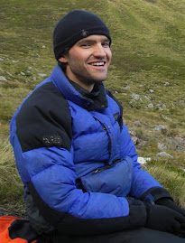
It was only on the steep sections, where you had to put force on your axes, that it began to fail. Kath, up from Edinburgh to get back into climbing, did a brillant job of seconding the pitch, but she left my Warthog in situ. Apparently it was my fault for placing it so well. All in, the first 40m had taken over an hour and if it didn't get easier above we were in for an epic. The next pitch was less steep and I quickly belayed 45m higher beneath an almost vertical wall of snow about 3.5m high. Once Kath came up and took over belaying I headed up and after floundering nearly to the top, a 1.5m section of snow slid off taking me with it. Kath by now had a sense of humour failure, but I was all up for having a second look. My falling had removed much of the snow and consolidated what remained. I was able to hook and scratch my way up over the bulging rock and completed the rest of pitch much more easily. At the top we came across footprints from our friends who had perservered with Acadamy Ridge. Kath again seconded with much more style than I could muster and lead off up following the footprints. It was now nearing 3 o'clock and I was getting worried as the guidebook mentioned meeting Acadamy Ridge. Did you meet the ridge where it was easy or below the harder section? If it did the latter we were stuffed. As I neared Kath's belay I could see a large rock tower up on the left. The footsteps, however continued straight up and on the sky line I could see our two friends waiting for us. Their lack of urgency and packed bags reassured me they had finished their climb. On my final belay I looked across to the Torridon hills in the distance and reflected on a climb that had pushed me physically and mentally.

As an aside I wore my heart rate monitor all day and to my surprise found out that I was working pretty much in my endurance training zone (70% of my max heart rate) all day. I didn't have the presence of mind to measure it during the route though ; ). Still, the 8 hour day should have done my endurance some good.

Monday 7 January 2008

Cross training - my thoughts

I am a big believer in cross training i.e. doing other things than your main sport. I know most runners just run and probably being specfic to one sport will give the best chance of performing well, but I just can't do it. If I ran 5 or 6 times a week I would just blow up or get injured within the month. But, perhaps it is my inability to concentrate on one task at a time that is the problem. Still, looking back at past seasons some of my best results have been achieved off 30km total running miles a week. I am in no way claiming to be good, but I have won the odd race, completed the Bob Graham with limited fuss and completed the OMM Elite so I would like to think I am a fairly competent fell runner. So, my weekly training at the moment is a hard short run (1h), a track session and one long run (2-4h) at the weekend. To that I add 2 long (1-2h) steady bike rides, some yoga sessions and a swim session. The amount of running seems quite low compared to a lot of other fell runners out there and I will just have to see in May whether my approach works for ultra races.

The main advantage of my approach is that it leaves a day on the weekend free just to have fun and not feel guilty about 'missing' a training session. After my cold and wet run near Inverness (just past Balnain) on Saturday around Eskdale Moor (the one up here not the lakes) which was 10M long took 2h over a mix of estate roads and rough moorland (bagging the peak Carn nam Bad on the way), I went east with Emily on Sunday. The forecast was great, but the main worry was the distinct lack of snow near Inverness. We put the hiking boots in with the xc-skiing stuff and it was only until just past Dufftown that there was snow on the ground. When we finally reached Clach forest however, (do a search for Huntly skiing on Google) there was snow everywhere and we had 3h of superb skiing. My technique leaves a lot to be desired and was a bit of a all-over muscle workout. I know I have just held forth on me not being a slave to a training programme, but I still felt the need for exercise so I went up Tap O'Noth, Scotland's second highest hill fort, which wasn't very far but steep. The 'short-cut' on the way down ended, as it so often does, with an ingloriuos battle through gorse. I had to stifle my frustrated yelps of pain as walkers wandered by a couple of meters away on the perfectly good path. A fantastic end to a great two weeks.

Friday 4 January 2008

Heavy snow???

So whilst the rest of Scotland is seemingly inundated with snow, up here in Inverness there is barely a dusting. Forecasts for heavy snow up here have been a bit optimistic and I will have to wait a bit longer for some cross-country ski-ing. It still feels cold and sunshine has been limited. Still the views yesterday from Dores down the Great Glen on my road bike ride were great. I put boiling water in my bottle which was ice cold within about 30min. The odd glimpses of sun were a real bonus and helped put those dark thoughts of returning to work behind me for a bit.

Today, Friday, I was meant to be taking it easy so I headed up to Tom Bailgean near Loch Duntlechaig. It is a small heathery hill with a mast on top with a south face of short conglomerate walls. From beside Loch Ceo Glais I headed up the obvious deep-cut gully in the south face for a bit of scrambling (with a couple of steep steps) and then slithered down the track which serves as an access for the mast. There was quite a breeze and the semi-frozen track was tricky in my disintergrating inov-8s. I used my new heart rate monitor to make sure I didn't try too hard which seemed to work. All good fun and even more stats to play with ; ). Still, another good short run near Inverness and back in time for tea and medals.

Time 30min, Distance 4km, Height 219moa, Av HR 149, Max HR 170